Wednesday, September 6, 2017

3 Guys, Beer and Craters of the Moon, ID

Miles Driven: 224.1 - September 14th Yellowstone, WY to Craters of the Moon, ID
Total Miles: 3191.7
Enterance Fees: $8 (covered by the America the Beautiful Pass)
Camping Fees: $10

I was in Montana for all of 10 minutes before entering into the state of Idaho where craters of the moon, my next destination was located.  The drive was great, the sun was out, and the temperature was great around 85 degrees.  Drove on roads where I was the only car most of the time if not all of the time.  Between the little towns, and by towns I mean four or five houses and maybe a gas station there was nothing.  Did not see any agriculture of any kind.  Stopping to take a photograph where I stood in the middle of the road.  Not a car insight.

Road ID
Now, I have to comment on the fact that this was not the first time I was on roads where I was the only car and would not be the last.  The first time I was in a situation like this you start to think of all the possible ways of what could go wrong.  First you check the cell reception.  No signal.  Then you check your gas level, half a tank, good for another 100 miles of so if the road is flat longer.  Check you have water to drink and food to eat.  Check, check.  Then you start to wonder, what if the brakes down.  What if you drive off the road.  What if you hit an animal.  And so many, many more what ifs keep coming.  Since this was not the first time I just enjoyed the sights.


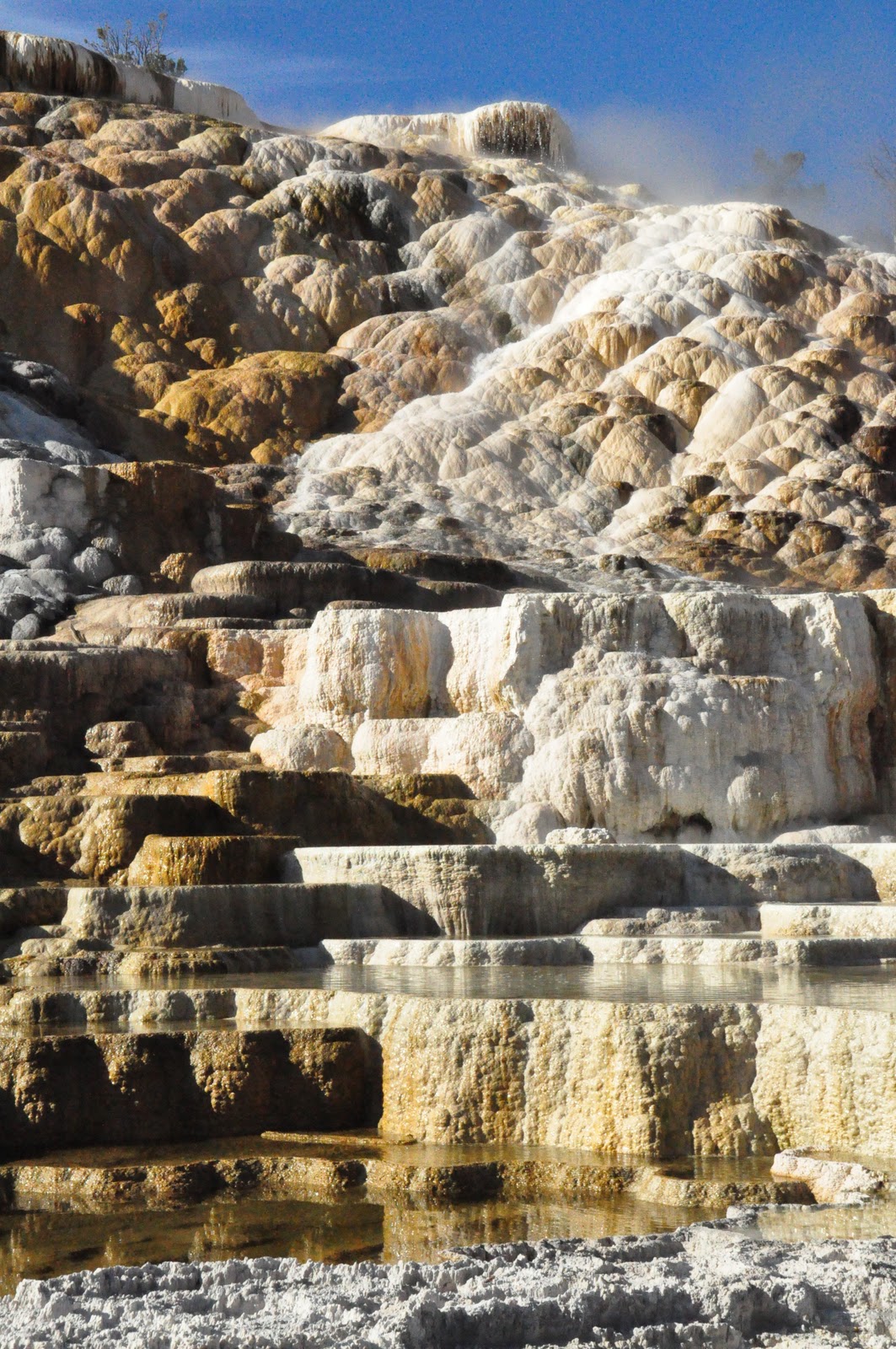
Arriving at Craters of the Moon around 4pm I parked at the visitor center, watched the movie, and chatted with the park ranger about what to see and do while I was in the park.  She suggested a hike on the rim of the crater and some caves, lava tubes.  There is a one way road around the lava beds.  I drove to the crater and walked around the ------- In llllllll there was still snow at the bottom even after the 100 degree days of summer.  Then hiked up to the crater and walked around the rim.  I lost my cap and had to chase after it.  The wind was really blowing.

After the crater hike a wanted to explore the lava tubes.  There were several to chose from and they were all located in the same place.  To get to the lava tubes you have to hike on a path through the lava beds.  The wind was not as bad as it was on the crater and the sun had come out from behind the clouds.  The temperature soared to 98 degrees and it was very dry.  I actually got sun burnt on the backs of my legs walking out to the lava tubes. 800 meters long and 30 wide and 30 in height.  It get to the bottom of the tube you have to go down a metal ladder part of the way and the rest is on lava.  You make your own way through the tube up and over and around lava.  It was so much fun.  Did not really need a flash light except for one really dark stop, which happened to be the flattest part.  Not that there was any real flat part, but the less of the ups and downs to cliff over.

To get out of the tube you have to climb up into a small hole and end up on the lava beds.  The only way you know how to get back to the path is the lava posts with wood sticking out of them.  Following them for about 500 yards and you are back to where you started from.  Although navigated the lava beds is not an easy task.  The heat radiating from the lava is incredible.  Should have put on sunscreen.

Further down the path, actually the end of the paved path is the lava tube called Beauty Cave.  This cave is described as enclosed and a flash light is a must.  The cave is 400 long, 200 wide and 20 high.  I walked into the cave about 20 feet.  Could not see a thing.  The little flash light I had was not doing a great job.  Now, I considered myself a strong, fearless, independent, even courageous woman at times, but being in a lava tube, not able to see your fingers even though you have put them up to your face I felt a little, how should I say this, scared.  Yes, I’ll admit it, I was scared.  But not for the reasons you are thinking.  If you know me, you know I can be a little accident prone.  While I was hiking into the dark lava tube a couple of scenarios starting to form in my mind.  What if fell and dropped the flash light.  I would not be able to find it in the pitch blackness.  What if I fell and really hurt myself.  No one know I was down here.  It was late in the afternoon and I was probably the last person to hike into the lava beds.  My car was the only car in the parking lot when I pulled in.  The lava tube was so much cooler than the surface, I’d get hypothermia and go into a coma.  And on and on, so I decided to do the smart thing and back track and get the hell out of the pitch black lava tube.  Now that’s what I call a very smart decision from a very independent, courageous women.

Heading back to my car the sun was beginning to set and I had not yet thought about where I was sleeping that night.  It just so happens there was a camping site in craters of the moon.  Pulling up to the board I noticed there were only a few places left.  Getting out of my car a men who was brushing this teeth commented on my Virginia license plate.  He said there was I place next to where he was camped.  He started to tell me but I told him to get in the car and show me.  

Bob was camping with two other guys, John and Sykes.  They invited me over for a beer.  I went over after I had set up my tent and paid for the camp site.  We chatted for several hours until it was to cold to be out in shorts.  And yes it was the coldest night thus far in the tent.  The low was 39 degrees.  

Saturday, October 9, 2010

Mammoth Hot Springs and Bison Jams Yellowstone, WY

Miles Driven:  64.8 - September 14th Mammoth Hot Springs to Madison, WY Yellowstone National Park, WY to Craters of the Moon, ID
Total Miles: 2967.6
Entrance Fees: $0
Camping Fees: $0

Another cold night in the car.  Getting up very early in Mammoth Hot Springs I decided to walk around the springs before I did the visitor center thing.  The self guided walking tour lasts about two hours.  For hundreds of years Shoshone and Bannock people collected minerals from Mammoth Hot Springs for white paint.  The minerals contribute to the beautiful terrace structures, together with heat, a natural plumbing system, water and limestone.   A network of fractures and fissures form the plumbing system, which allows hot water from underground to reach the surface.  Hot water with dissolved carbon dioxide makes a solution of weak carbonic acid.  As this weak solution rises through rock, it dissolves calcium carbonate, the primary compound in limestone.  At the surface, the calcium carbonate is deposited in the form of travertine, the rock that forms the terraces of Mammoth Hot Springs.

Minerva Terrace, Mammoth Hot Springs Yellow Stone, WY
Each part of the Mammoth Hot Springs area has its own name starting with the terraces of Opal, Minerva, Jupiter and Mound.  Jupiter terrace stopped flowing in 1987.  The only flowing terrace at present is Palette Spring.  You can see the changing colors of orange and brown as the water cascades down the terraces.
Palette Springs Mammoth Hot Springs Yellowstone, WY

Palette Spring Mammoth Hot Springs Yellowstone, WY

You can also see a dormant hot spring called the ‘Liberty Cap’.  Its internal pressure was sufficient to raise the water to a great height, allowing mineral deposits to build slowly and continuously for hundreds of years.  Devil’s thump is an active hot spring, much smaller than liberty cap.

Liberty Cap Mammoth Hot Springs Yellowstone, WY
Heading back to the Mammoth Village visitor center after walking around the springs I watched the movie.  It was after noon by the time the movie was over and I needed to be on the road.  Having spent two nights and  almost three days in the park was not nearly enough time to see everything, but the west coast was calling and I had other places to see before I reached the coast.

I put my next destination into Penelope (GPS) and she wanted me to drive around a mountain, which would have added another 150 miles to my already long trip.  I consulted the Yellowstone map and made my own way out of the park via the west entrance (exit), which happened to be in Montana.  Thinking of the figure of eight again, Mammoth Hot Springs in on left corner of the top circle.  All I needed to do was drive down the left side of the circle to where the two circles of the figure of eight meet and drive out west (left).  Driving took longer than expected due to the bison jam, but it was worth the wait.

Bison Jam Yellowstone, WY

Sunday, October 3, 2010

Old Faithful was Faithful as usual Yellowstone, WY

Miles Driven: 81.5 September 13th Fishing Village to Old Faithful to Mammoth Hot Springs, WY Yellowstone National Park, WY
Total Miles: 2928.8
Camping Fees: $0

Yes, it was very, very, very COLD all through the night and into the following morning my first night in Yellowstone.  Even though I was awake before the sun rose I stayed in my sleeping bag until the temperature had risen.  The visitor center was just across the road and was about to open.  I chatted with the park rangers and asked what time “old faithful” was due to go off.

What you need to know about Yellowstone is how big the park is in acreage, just over 2 million acres.  So getting from one visitor center to another takes a least an hour and that is without stopping or any traffic on the roads.  To describe the road system in the park, think of a figure of eight.  I entered via the east entrance (6951 feet elevation) just about half way down the second circle of the figure of eight.  Old Faithful is on the west side of that same circle about 61 miles away.  And of course there were oodles of sites to see in-between.  12:18pm was the time I was aiming for, which give me about three hours to site see along the way and get through the construction on the roads.  Finding a nice spot to eat breakfast was not that hard.  I drove over Fishing Bridge and sat on the grass next to Yellowstone Lake where the sun was getting higher and higher.  (If you look closely, just below the tree line on the right side is a buffalo (bison))  

Yellowstone Lake at Fishing Village, Yellowstone NP, WY
Yellowstone NP, WY
Arriving at Old Faithful Visitor Center about 11:30am allowed me time to peruse the stores and read all the information on Old Faithful.  Old Faithful is one five geysers predicted by the park rangers and is located in the Upper Geyser basin along the Firehole River.  Only four other locations in the world have large concentrations of hydrothermal features - Russia (Kamchatka), Chile, New Zealand and Iceland.  Yellowstone has ample evidence of volcanic geology and magma provides the first ingredient for thermal features.  HEAT.  Rain and snow provide the second.  WATER.  Water seeps down several thousand feet below the surface where it is heated.  Underground cracks form the third ingredient: NATURAL PLUMBING SYSTEM.  Hot water rises through the plumping system and to produce springs and geysers.

Finding a good stop after reading up on Old Faithful was tricky.  Seeing that all the seats were taken I sat on the ground in front of the wooden benches. There were hundreds of people sitting and standing around waiting for old faithful to blow.  I mentioned to the people sitting next to me “I have never seen so many people be so patience in my life“.  The crowd was relatively quiet in anticipation.  Something you do not see on a regular basis.

Old Faithful had some performance anxiety and some ‘pre flow’ before the big show.  Old Faithful was due to go off at 12:18pm but can go anytime within 10 minutes of that time.  At 12:20:42pm the real show started just as the sun went behind the clouds.  Old Faithful eruptions last anywhere from 11/2 to 5 minutes and are about 90 minutes apart varying from 51 to 120 minutes.  3,700 to 8,400 gallons of boiling water reach heights of 106 to 184 feet.  The show I was watching lasted 2 minutes.  I can now check that off my list.
12:20:40pm Old Faithful Blow Yellowstone, WY

Having seen the eruption I headed to my car where I wrote a bunch of post cards for an hour or so.  Old Faithful is located in the Upper geyser basin.  As you travel north you go through Midway and Lower geyser basins.  Think of the figure of eight, Old Faithful would be on the lower left corner of the lower circle and as you move up the left side of the lower circle midway would be in the middle and lower geyser basin would be close to the top.


Shell Spring, Biscuit Basin Yellowstone, WY


Avoca Spring Biscuit Basin Yellowstone, WY


Excelsior Geyser, Midway Basin Yellowstone, WY

Just before you enter the midway basin region you travel through biscuit basin.  This area has a tremendous amount of springs and mud pools each having their own names such as shell pool, avoca spring,  sapphire  pool, and black opal spring  And each one of these pools or springs was unique.

Having driven further up the road I was now in midway geyser basin where Grand Prismatic Spring is located.   But first you pass turquoise pool, excelsior geyser and then opal pools.  These were bigger than the biscuit basin springs and pools.

Grand Prismatic Spring Midway Geyser Basin Yellowstone, WY
On the road again I was headed toward Canyon Village.  On route I encounter a bison just strolling in the middle of the road minding its own business.  This was a reminder to keep to the speed limit of 45mph or less.  The newspaper given to everyone who enters the park states that about 100 animals including bear, elk, deer, wolves and bison are killed each year due to speeding drivers.  I did not what to add to that number.


Bison (buffalo) on road to Canyon Village Yellowstone, WY

If you think of the figure of eight, Canyon village would be on the right hand lower side of the upper circle, 40 odd miles away from the geyser basin regions.  The scenery starts to change as you travel around this area.  Gone are the springs and pools, enter cliffs and large prairie fields where I spotted another bison.

Changing Scenery on route to Canyon Village Yellowstone, WY
Canyon village is named for the Grand Canyon of the Yellowstone river.  The canyon is 20 miles in length, over 1,000 feet deep, 1,500 - 4,000 in width (depending on where you are located), 109 feet of height in upper falls and 308 feet of height in the lower falls.  Just getting down to the brink of the lower falls trail you descent on a steep trail that drops 600 feet.  Before you start to head down the trail there are warnings NOT RECOMMENDED FOR THOSE WITH HEART, LUNG, OR OTHER HEALTH CONDITIONS.  The hike down was fine, but boy oh boy getting back up was a major effort, but well worth the effort.

Grand Canyon at Yellowstone River Yellowstone, WY

You can drive the north rim and stop at many points to take photographs, which I did ending at inspiration point.

Looking back at the Canyon from Lookout Point Yellowstone, WY
The sun was setting and I needed to be at Mammoth Hot Springs Visitor center for a camp site, which was another 40 odd miles away.  Plus I did not want to drive in the dark again especially with all the wild life roaming around at dusk.   And low and behold what should I see around a bend but a bison.  Further down the road I almost hit a wolf and elk were running across the road.  Neither of these could I catch with the camera.  But I did see them none the less.

Getting to the camp site at Mammoth Hot Springs in the dark, I missed the last spot by 15 minutes.  Blame it on the wild life.  So I found a nice quite place to park close to the visitor center.  Another cold night was on tap.    

A Long Day's Drive to Yellowstone National Park, WY

Miles Driven: 485.0 - September 12th Sundance, WY to Yellowstone National Park, WY
Total Miles: 2847.3
Entrance Fees: $25 (covered by America the Beautiful Pass)
Camping Fees: $0

The nights are getting colder the further north west I travel and Sundance, WY was no exception with a low around 51 degrees.  Could not seem to get warm and kept waking up.  The sun was up early and so was I with it.  I spent some time repacking my car.  Another long day of driving was in store on route to Yellowstone National Park, WY.

Just off I90W Buffalo, WY

I traveled I90 for several hours until I was in Buffalo, WY where Penelope (GPS) instructed me to take US16.  Now that I was off the interstate I could easily stop and take some photographs.  The photograph below is of the snow capped mountains I was headed towards.

Ten Sleep Canyon, WY
I drove through Ten Sleep Canyon where there is a monument for an English nobleman by the name of Gilbert E. Leigh.  Leigh was a lifelong big game hunter and outdoor enthusiast.  He went missing in the fall of 1884 during a hunting expedition.  Unfortunately, after a week long search his body was found 100 feet below the canyon wall where he had fallen pursuing mountain sheep.  The monument is laid up of native stone in dry mortar and is approximately ten feet square at the base and contains a marble slab with an inscription memorializing Leigh who was buried in Stoneleigh, England.

Driving through Meeteetse, WY around 7:30pm as the sun was beginning to set I saw some amazing colors so I stopped and snapped some photographs.  The blue and pink are a great combination over the empty road I am traveling alone.
Greybull HWY, Meeteetse, WY

If you are traveling to Yellowstone from the east, as I was you must drive through the town of Cody, WY.  As I was rounding a corner the moon was rising over a lake and I stopped to snap a photograph.


Moon Over Lake in Cody, WY
By the time I entered Yellowstone National park it was dark, very dark.  I know I missed loads of scenery on my way to the Fishing Village Visitor Center, which was yet another 25 miles ahead of me from the entrance on very tight and windy roads.  Could not be helped due to the time I arrived.

Pulling up to the camp grounds in Fishing Village and reading the rules for camping I found there was no canvas tents allowed due to bears being sighted in the area.  Not given any choice I had to spent the night in the car in the parking lot across the road from the visitor center.  The temperature was dropping rapidly as I was setting up my car for sleeping.  By the time I had finished the temperature was 45 degrees and I had a feeling it was going to get colder.  Sleep could not come quick enough as I curled up like a cocoon in my sleeping bag ready to explore Yellowstone in the light of day.    

Sunday, September 26, 2010

President and Accounted for Mount Rushmore and More, SD

Miles Driven: 150 (includes driving around Blacks Hills) September 11th Wasta, SD to Mount Rushmore, Crazy Horse and Custer State Park to Mount Rushmore, SD to Sundance, WY
Total Miles: 2362.3
Parking Fees: $10
Camping Fees: $0

Spent the morning driving through Wyoming to get to Mount Rushmore.  I reached the Black Hills at noon.  Getting to Mount Rushmore requires you to drive up into the snaking roads of the Black Hills.  Just as you round a corner the monument looms in the distance.  Now I don’t want to say I was disappoint, but maybe a little under whelmed.  I have seen many a photograph and it looks bigger in a picture than is does in real life.
Mt Rushmore Avenue of the Flags, SD
Don’t get me wrong, I believe that the monument is an amazing piece of art, its just smaller than I expected.  I drove further up the road to the entrance.  There is not an entrance fee but there is a parking fee.  Walking up the Avenue of Flags to the Grand View Terrace you see the four Presidents in all their glory.  OK, off the top of your heads who can name them?  You’ve got 10 seconds and no cheating go ……….From left to right, George Washington, Thomas Jefferson, Theodore Roosevelt and Abraham Lincoln.   I must admit I only got three of the four.  And they represent the birth, growth, development and preservation of the nation.

To early for a good photograph and the lighting ceremony I went off down the road (hills) to Crazy Horse.  Wow, Crazy Horse is massive compared to Rushmore.  Size wise, the four heads of the presidents will be able to fit into the hair of crazy horse.

Crazy Horse, Black Hills, SD

1/34th Model Crazy Horse Black Hills, SD
It has taken 50 years just to finish the head, now they are working on the horse.  As crazy horse is an active blast site, walking up to the mountain is prohibited.  Taking a $4 bus ride will get you to the bottom but the lines were to long.  The sculptor, Korezak Ziolkowski twice turned down $10 million dollars from the Government saying the memorial “is for the people, by the people“.  I hung around the view veranda taking photographs.  There is a 1/34th crazy horse model that you can get an idea as to how the finished memorial will look.  Thing is it will not be finished for at least another 100 years.  Taking a piece of rock I left and headed to Custer State park.

Custer State Park, SD
Custer State park is further down the road and is nestled in the Black Hills.  Not having much time as the sun was setting I came across a lake and took a couple of photographs of the sun setting over a ripped lake.  Not bad if I do say so myself.  Heading back to Rushmore for the lighting ceremony I was reminded of the day, September 11th.  There was an extra long ceremony and blessing for all soldiers past and present ending with the national anthem.  As I did not put my hand over my heart and sing, not American, I was spotted by another English couple, They were here on holiday and had just come from Yellowstone my next destination.  We are everywhere…

Mount Rushmore Light Up, SD


Needing to be on the road for awhile I drove for an hour so until I came across a rest stop.   The rest stop was just inside the state line in Sundance, WY.

Tuesday, September 21, 2010

In and Around the Badlands, SD

Miles Driven: 75 - September 10th The Badlands, SD to Wasta, SD
Total Miles: 2212.3
Camping Fees: $0

Waking up in the morning I felt parts of my sleeping bag where wet, so was my sleeping pads that where under a large blanket covering the entire tent.  The sun was out and it was windy.  Hanging everything up to dry in the camp shelter took awhile.  I threw the blanket over a couple of my car doors and waited for all to dry while I put the kettle on for tea and had breakfast.  Everything dried in about an hour.  The wind is great sometimes.

Drying Out After Heavy Rain Storm Badlands, SD
The Badlands are a place of extremes.  The summer is hot and windy with ever changing temperatures due to the fast rolling storms.  I had to sit in the car for hours while another rain storm rolled in and out.  I   drove to the Ben Reifel Visitor Center to chat with the rangers for the best places to take photographs.  While there I watched the movie and chatted with the rangers to find the best places to see bison (buffalo).  I stopped at almost every view point and took photographs.  Each place had something different to offer. Late in the afternoon I hiked up a rock formation and slide on the wet clay taking a nice rash to my right leg.  

Sun beginning to set I headed to the spot I spied the day before.  I had obviously picked the correct place as there was a professional English couple set up with their cameras too.  We chatted for a while waiting for the sun to go down.  I took about 75 photographs to get the “money shot”.  

Sun Setting Panorama Point Badlands, SD
Needing to leave the Badlands for my next destination I spied the moon raising over the rocks and had to stop and try my hand at getting a quick money shot there too.  You be the judge.

Moon Rising Over Badlands, SD
Nabbing the moon shot I left the Badlands and hit the road for a couple of hours.  I drove until I could not keep my eyes open any longer.  I pulled into a rest stop in Wasta, SD and spent the night in my car. The temperature was 55 degrees when I pulled over.  Wasta is off Interstate 90.  

Badlands National Park, SD are so Good.

Miles Driven: 24.7 September 9th Wall Drug, SD to The Badlands, SD
Total Miles: 2137.3
Entrance Fees: $15.00 (covered by America the Beautiful Pass)
Camping Fees: $14.00

Only minutes from Wall Drug, I entered the Badlands via the Pinnacles Entrance.  In another 10 minutes or so and around a corner, bang, your jaw drops and you almost drive off the road.  The Badlands are breathtaking. They appear out of nowhere. What you see is absolutely amazing.  It is hard to put into words what you see.  The Badlands are notched into the landscape in some areas, while in other places they grow up out of the ground.
Pinnacles Overlook Storm Approaching Badlands, SD

Pinnacles Overlook The Badlands, SD

Pinnacles Overlook is where I stopped and stayed for hours just taking in the sites with over 300 photographs.  In the distance, a storm was approaching, which made great scenic shots.  Some goats came wandering up out of the canyon and started munching on the grass growing around the parking area.  The males had  neck tags on to monitor their whereabouts.

Mountain Goats Pinnacles Overlook Badlands, SD
Lightening Bolt Camp Site Badlands, SD
As the sun was setting I drove further into the Badlands to look for a camp site.  Driving around the roads in the waning light looking at all the different kinds of rock formations gave me ideas on where to head out in the morning.  The storm was getting closer and closer and I wanted to get my tent up before it started to rain.  The wind picked up and I had to steak the tent and fly down.   As soon as the tent was up and secured the winds and rain came.  The storm, which looked great in the distance was not great in the here and now.  There were massive jagged bolts of lightening lighting up the sky.  The thunder vibrating off the rocks at times was deafening.  Trying to take a photograph of lightening is somewhat impossible.  My Nikon D90 wants to focus on an object before you can take a photograph, trying to focus manually on an object that is not there yet does not work.  So I opted to try with my little Sony point and shoot digital camera.  I had some luck, but again shooting in the dark waiting for lightening to happen is hard.  The shot I did get is a bit out of focus but it should give you an idea of the storm.

Raining for hours my tent was starting to leak in each corner.  Finding only socks in the dark I soaked up the water and rang it out in a plastic container, which I then had to empty out.  These actions were repeated well into the night.  Several hours later the rain stopped and I could get some sleep.  

Monday, September 20, 2010

Missiles and Drugs, Oh My!

Miles Driven: 340 September 9th - Brookings, SD to Minuteman Missile National Historic Site, SD to Wall, SD
Total Miles: 2112.6
Camping Fees: $0

Huron, SD

Brookings, SD is a big town compared to the rest of the towns I drove through on my way to The Badlands, SD.  I woke up to rain and cold around 55 degrees in the Wal-Mart parking lot.  On the road early, I watched the vast landscape of nothing between the little towns.  Huron, SD boasts they are the home to the world’s largest pheasant, in case anyone ever gets that question in a pub quiz.

Pierre, SD State Capitol
Prairies Pierre, SD 
Pierre, SD  the state capitol, on the other hand is where they filmed Dances with Wolves, again, good to know if you are ever in a pinch.  I was driving through vast prairie lands of undulating hills and I could image the scenes from the movie.  Once you leave Pierre there is a sign informing you that there are NO SEVICES for 68 miles, so make sure you check your gas level.  Not sure what I was thinking because I was on fumes after pulling into the gas station 68 miles down the road in Middletown, SD.

County Road 44, Philip, SD
Penelope (GPS) is set to use “least amount of highways” when I drive to a destination.  As a rule, I do not drive on the highways because I want to see the little towns of middle America.  But in this case I should have been driving on the highway as Minuteman Missile is just off Interstate 90.  As I was on Route 14 I was directed to go onto County Road 44.  Basically, a county road in that part of the state is a dirt track between fields of cows.  I drove down roads that were meant for tractors.  My wheel axels did not span the  dirt tracks and having to negotiate the roads was tricky at times.  Bumping down the roads I saw many hundreds of crickets jumping to their deaths on the front of my grill and windshield.  I stopped on a makeshift bridge to snap a photograph of a really gnarly looking dead tree.

Gnarly Tree County Road 44, Philip, SD
Ending at the Missile Site I was instructed that to gain access I needed to go back to exit 131 about 30 miles up the road.  Calling I found there was limited spaces and the dates had been booked for the next couple of weeks.  Instead I snapped a couple of photographs and made my way to Wall Drug.


By the time I drove into Wall, SD around 3pm the sun was out and I was famished.  Wall Drug, how does one describe this place?  I would call it an over glamorized small mall in the middle of nowhere.  Don’t get me wrong, it was very cool walking around the multiple stores looking at the over priced items for sale.  As soon as you enter the state you see signs for Wall Drug.  I started seeing signs 250 miles away.  The Husteads who own the store, moved into the back of the store in 1931.  The store did not do well for the first 5 years.  The summer of 1936 so hot and Dorothy Hustead had an idea to put up signs for free ice water.  The people who had been driving for hours came in droves.  This was the beginning of a legend in the making.  Anyone who lives in South Dakota will let you about the store.

Wall Drug Wall, SD
I headed straight to the Western Art Gallery CafĂ© for a hot roast beef sandwich with mashed potatoes and homemade gravy.   The sandwich did not disappoint.  Gravy was spilling over the edges and there was two huge lumps of mashed potatoes and the roast beef just melted on your month.  I finished off my late lunch with some soft served ice cream.

Stuffed Bison Wall Dug Wall, SD
Walking around Wall Drug I stopped in most of the stores just to window shop.  I did buy a t-shirt and picked up a free Wall Drug bumper sticker.  After spending 2 hours in the store and in the back yard where you can get your picture taken next to a stuffed bison and in a card board cut out of Indians in wigwams I was looking foreword to see the Badlands.

Sunday, September 12, 2010

Put it in your Pipestone, MN and smoke it.


Miles Driven: 49.5 - September 8th Pipestone, MN to Brookings, SD
Total Miles: 1772.6
Entrance Fees: $3.00 (covered by America the Beautiful Pass)
Camping Fees: $21.35

Dino drinking hot cup of tea, Pipestone, MN
The night was cold, very cold.  Waking up around 7am the temperature was 51 degrees.  I laid in my sleeping bag for another hour reading hoping it would get warmer.  When I finally poked my head out of the tent the temperature had risen to 60 degrees.  Time for a nice hot cup of tea and some breakfast.  Putting the tent away and packing the car I went to the office to pay and take a long, long shower before heading to Pipestone National Monument.    

The 15 minute long video explained the origins of the Pipestone (Catlinite) and its significations in today’s American Indian culture.  Pipestone can vary in color from mottled pink to brick red.  The stone is durable but yet relatively soft.  If you drop a carving it will probably break into pieces.  Specimens dating back 2,000 years have been found in Mound City, in today’s Ohio.

Petroglyphs, Pipestone, MN
The Pipestone location became the preferred place to quarry the stone around 1700 when Dakota Sioux controlled the quarries and only distributed the stone via trading.  

“Ceremonial smoking - rallying forces for warfare, trading goods and hostages, ritual dancing, and medicinal healings - marked the activities of the Plains people.”


Old Quarry Pipestone, MN
By the 1800’s pipes found their way into non-Indian societies through trade and effigies honored politicians and explorers; some caricatures where far from flattering.  Pipes and the Pipestone became a source of income for their makers and families.  To protect the Pipestone source from the White man, the Yankton Sioux secured free and unrestricted access by an 1858 treaty.  American settlement threatened to consume the square-mile reservation.  Outsiders were digging new pits and extracting the sacred stone.  In 1937 Congress established Pipestone National Monument to provide traditional quarrying for American Indians.


Quarrying today is very similar to how the stone was quarried in the past, by manual labor, brute force, sledge hammers, shovels, pry bars, chisels, wedges and picks.  No other tools are permitted in the sacred grounds for quarrying.  It can take anywhere from one to five years for an American Indian to gain access rights to quarry for the stone.

Oracle (Medicine Man) Pipestone, MN
Once you have gained access the real hard work begins.  Before one can get to the Pipestone there are several layers of hard Sioux Quartzite with visible cracks and fractures.  Once the Pipestone is exposed care must be taken to remove it.  The layer is only 14 to 18 inches thick, but only about 2 inches of that is ideal for carving pipes.  The Pipestone has natural fissures and must be removed layer by layer very meticulously.

After spending most of the day at Pipestone National Monument, the little town and writing post cards, I hopped on the road and drove to Brookings, SD where I slept in my car in a Wal-Mart parking lot.

Circle Trail Walk, Pipestone, MN


Saturday, September 11, 2010

Corn Anyone? IA

Miles Driven: 343.4 September 7th - Effigy Mounds, IW to Pipestone Monument, MN
Total Miles: 1723.1
Camping Fees: $21.38

Route US-75 Rock Rapids, IA
On the road again!  Iowa is flat, very flat.  There were fields upon fields upon fields of patch work quilted corn fields as far as my eyes could see.  The weather was getting warmer as the sun was bursting through the clouds.  At 2:30pm I stopped in the middle of nowhere and got out to take a photograph of the empty road, a pink road at that.

Route US-18 Waucoma, IA
There were mostly trucks and the occasional camper vans and RV’s on the road.  We were far out numbered by the trackers in various colors and sizes.  In-between the very small towns were tractor and farming equipment dealerships.  It was also nice to see wind turbines peppered on each new horizon.   And, of course there were silos, though the silos in Iowa were more stand alone than in Wisconsin.

Route US-18 Waucoma, IA
Arriving at Pipestone around 8pm I looked for a camp ground.  Just across the road from the monument was a family run camp ground off of Hiawatha Ave.  The office was closed, reading the self help information I found a tent site and pitched my tent.  Looking forward to stretching out instead of sleeping in my car.